Gunnison County Colorado Property Search, Owner & Parcel Lookup
Search property records in Gunnison County, Colorado by choosing a single search method: parcel number, owner name, or property address. For precise results, enter the parcel number with spaces (example: 245 00 002 001). Quickly access full property details, ownership history, and public record information.
Colorado Property Search
Search Colorado public parcel records by address and owner information
Search Colorado public parcel records by address, owner name, city, ZIP code, or parcel ID
The Gunnison County Assessor conducts an annual property review in Gunnison County to establish updated market values for both residential and commercial real estate. Most properties are evaluated every year to ensure property taxes reflect accurate and fair valuations. According to official county records, Gunnison County currently manages over 18,000 parcels.
Each parcel is assigned a distinct parcel number, enabling users to search by property owner name, property address, assessed value, land dimensions, building features, and tax details. This transparent assessment process ensures reliable public records and promotes equitable property taxation throughout Gunnison County.
Gunnison County, Colorado Property Data – 2026
Gunnison County’s 2026 property data shows 11,909 residential and 844 commercial properties. Average single-family homes are 1,900 sq. ft. and 39 years old. About 34.34% of homes are equity-rich, with only 0.65% seriously underwater. The effective property tax rate is 0.35%, and foreclosure activity is low, with three filings year-to-date. Residential sales totaled 406 in 2025, with 67 recorded so far in 2026.
11,909
Total Residential Properties
67
Total 2026 Residential Sales (year-to-date)
844
Total Commercial Properties
0.65%
% of Homes Seriously Underwater (Q2 2025)
0.35%
Effective 2025 Property Tax
39 Years
Avg. Home Age (Single Family Home)
406
Total 2025 Residential Sales
3
Total Foreclosure Filings (year-to-date)
1,900
Avg. Square Feet (Single Family Home)
34.34%
% of Equity Rich Homes (Q2 2025)
Popular Cities in Gunnison County, Colorado
Gunnison County’s key towns contain the majority of its residential and commercial parcels. Gunnison, the largest town, has 5,120 parcels, Crested Butte accounts for 3,450 parcels, and Marble contains 980 parcels. Understanding these city-level property counts helps homeowners, investors, and real estate professionals evaluate market scale, property distribution, and tax planning across Gunnison County.
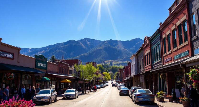
5,120 Parcels
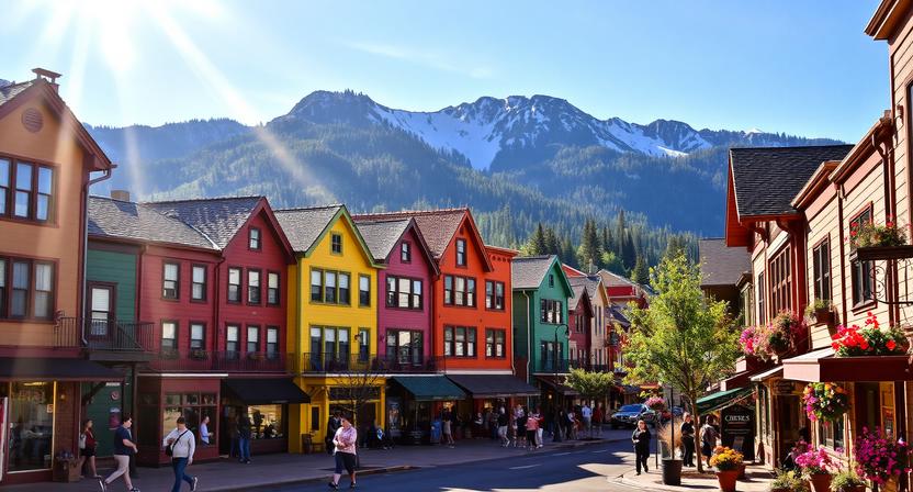
3,450 Parcels
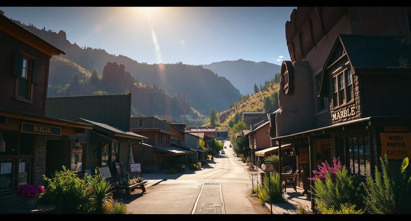
980 Parcels
4 Best Ways to Find Property Records in Gunnison County, Colorado
Our Gunnison offer 4 simple ways to access accurate public property records online for free. You can search by owner name, parcel number (PIN), property address, or city name to quickly find ownership information, assessed value, sales history, building details, and complete property data.
Gunnison County property search by owner name
Enter the full name of a property owner to access a complete profile of ownership history, current and past assessed values, property characteristics, parcel dimensions, tax information, and related public records maintained by the Gunnison County Assessor’s Office, providing a comprehensive view of the property’s official data and transaction history.
Gunnison County property search by parcel PIN
Use the property’s unique parcel number to instantly retrieve detailed records including lot size, building features, assessed and market values, tax obligations, historical sales, and other official documentation, ensuring a precise and efficient search for any specific parcel in Gunnison County.
Gunnison County property search by property address
Search using the street address to quickly locate the property’s current ownership details, assessed valuations, tax records, building information, land specifications, and past transaction history, giving homeowners, buyers, and real estate professionals easy access to verified public records.
Gunnison County property search by city name
Filter properties by town, such as Gunnison, Crested Butte, or Marble, to narrow your search within a specific area, allowing you to efficiently view local ownership, assessed values, tax data, land and building details, and historical property transactions maintained by the Gunnison County Assessor.
What Information You Get with Our Gunnison County, Colorado Property Appraiser Tool
Our Gunnison County property search tool provides complete public record information for every property inquiry. Whether searching by owner name, parcel number, or property address, users can access official ownership data, assessed and market values, tax information, land and building details, and verified county appraisal records—ideal for research, investment evaluation, or property verification.

Parcel Number
A distinct code assigned to every property in Gunnison County, used for official tracking, tax assessments, and record organization, allowing users to quickly locate detailed ownership history, view past sales, assess land and building values, and access all related official county documentation for research or investment purposes.

Account
The official property account number maintained by the Gunnison County Assessor’s Office, serving as a unique reference for all administrative, taxation, and recordkeeping purposes, enabling precise management of ownership details, assessed values, and legal property information.

Street Address
The physical location of the property in Gunnison County, which confirms parcel identity and connects it to ownership records, assessed valuations, building and land details, tax obligations, and historical transaction information for accurate public record tracking.
City Name
The town or municipality where the property is located within Gunnison County, influencing zoning rules, local taxes, municipal services, and providing context for regional planning, property comparisons, and community-specific ownership trends.
Primary Surface Owner
The legally recorded individual or entity recognized as the owner of the property in Gunnison County, responsible for paying taxes, maintaining title rights, and fulfilling all legal obligations associated with the parcel, while being the main point of record for official county documents.
Owner Street Address
The mailing address of the registered property owner in Gunnison County, used for official correspondence, tax notifications, verification of residency, and identifying investor or out-of-town ownership patterns for research purposes.

Owner City
The city linked to the property owner’s mailing address, which helps identify residency location, analyze investor or owner distribution across Gunnison County, and provide context for demographic, market, or taxation research.
Owner ZIP
The postal ZIP code of the owner’s mailing address, aiding in accurate communication, demographic analysis, regional property ownership studies, and supporting official Gunnison County records and investment research.
Legal Description
The subdivision, lot, block, and other formal details describing property boundaries in Gunnison County, used for title verification, official mapping, legal research, and ensuring accurate recording of parcel dimensions and ownership information.
Parcel Square Footage
The total land area of the property in square feet, offering insight into lot size, potential development opportunities, zoning considerations, and supporting investment or planning decisions within Gunnison County.
Parcel Acres
The property’s total land area expressed in acres, providing a clear understanding of parcel scale, zoning implications, land use potential, and value assessment for residential, commercial, or investment purposes.

Price of Last Sale
The most recently recorded sale price for the property, serving as a benchmark for market valuation, historical price trends, investment analysis, and comparison to other parcels within Gunnison County for informed decision-making.
Tax Land Use Description
The official classification of the property as residential, commercial, or vacant land according to Gunnison County records, determining applicable taxation, guiding regulatory compliance, and helping assess the property’s permitted use and investment potential.
Subdivision / Condo Name
The officially recognized neighborhood, subdivision, or condominium name for the property, useful for identifying location, conducting market research, evaluating comparable properties, and understanding community or development trends in Gunnison County
Taxable Value
The portion of the property’s assessed value that is subject to property taxation in Gunnison County, which determines the annual tax owed, supports accurate tax administration, and informs owners and investors of their financial obligations.
Parcel Total Value
The total assessed value of the property, including both land and structures, as determined by Gunnison County, serving as the official figure for taxation, valuation, investment analysis, and maintaining precise public records for all property transactions.
Gunnison County Property Tax & Demographic Data
Access the most recent Gunnison County, Colorado property tax and demographic information across key towns and communities. This overview provides estimated parcel numbers, population figures, land area, millage rates, and projected median tax bills, offering homeowners, buyers, and investors the data needed to make informed decisions about property ownership, taxation, and local real estate opportunities.
| City / Town | Population (Est. 2026) | Area (Sq. Mile) | Total Parcels (Approx.) | Millage Rate (2026) | Median Residential Tax Bill |
|---|---|---|---|---|---|
| Gunnison | 6,821 | 4.85 | ~21,241 (County-wide) | 51.575 | $1,860 |
| Crested Butte | 1,230 | 0.8 | Contact Assessor | 11.855 | $2,400+ |
| Mt. Crested Butte | 961 | 2.05 | Contact Assessor | 10.378 | $3,000+ |
| Marble | 105 | 0.37 | Contact Assessor | ~45.000 | $1,200 |
| Pitkin | 72 | 0.27 | Contact Assessor | ~48.000 | $1,100 |
Explore Nearby Counties Around Gunnison County
When you’re looking into property across Gunnison County, it helps to think beyond a single map boundary. This part of Colorado is shaped by elevation, remote access, and seasonal demand, so nearby counties can feel completely different in terms of pricing, availability, and how properties are actually used throughout the year.
|
Montrose County Property Search |
Saguache County Property Search |